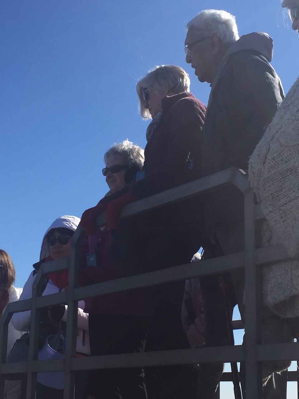
After Capernaum, we proceeded to Mount Bental in Golan Heights. On the way to the top of the Mount Bental to see Syria, Lebanon border from Israeli-occupied territory.
View of Syria, Lebanon border from the Israeli side
On our way, we passed some interesting metal cutouts of Soldiers, which is a spot for Israeli kids to play. This area is a popular tourist attraction. While we were there, we saw many tourists, school groups, and families with kids.
We saw the Dmz area, which is now an area of ruins of the town of Quinetra captured by the Israeli military in the 1967 Six-Day War. I think It is the same area called the Valley of Tears because of the destruction caused during the war.
The site of a major battle in the 1973 Yom Kippur war, known as the Valley of Tears Battle.
We went up to see Mount
Hermon on the border of Syria and Lebanon. The southern slopes of Mount Hermon
extend to the Israeli-occupied portion of Golan heights.
Golan Heights, IsraelBorder of Syria and Lebanon
There is a café called Coffee Annan (a pun on both the UN leader and the Hebrew for Coffee of the Cloud.
Cafe Coffee Annan, Golan Heights, Israel
It was a historic location worth visiting. I know we will not do it again. Loved it!
We spent the night at Nof Ginosar Hotel in the Galilee region. We began our next day with Capernaum, a fishing village and currently an archeological site situated on the banks of the Sea of Galilee. The Pristine Sea of Galilee is the largest freshwater lake in Israel. After leaving Nazareth, Jesus moved to Capernaum, which became his home and a center of His ministry where he also performed miracles.
Capernaum, Israel
It is home to a celebrated Byzantine-era synagogue. The remains of the buildings and synagogue exist. It was a place Jesus healed a paralytic and St. Peter’s mother-in-law. And archeologists found that the St. Peter’s Church was built on top of St. Peter’s home. The site is a major tourist attraction.
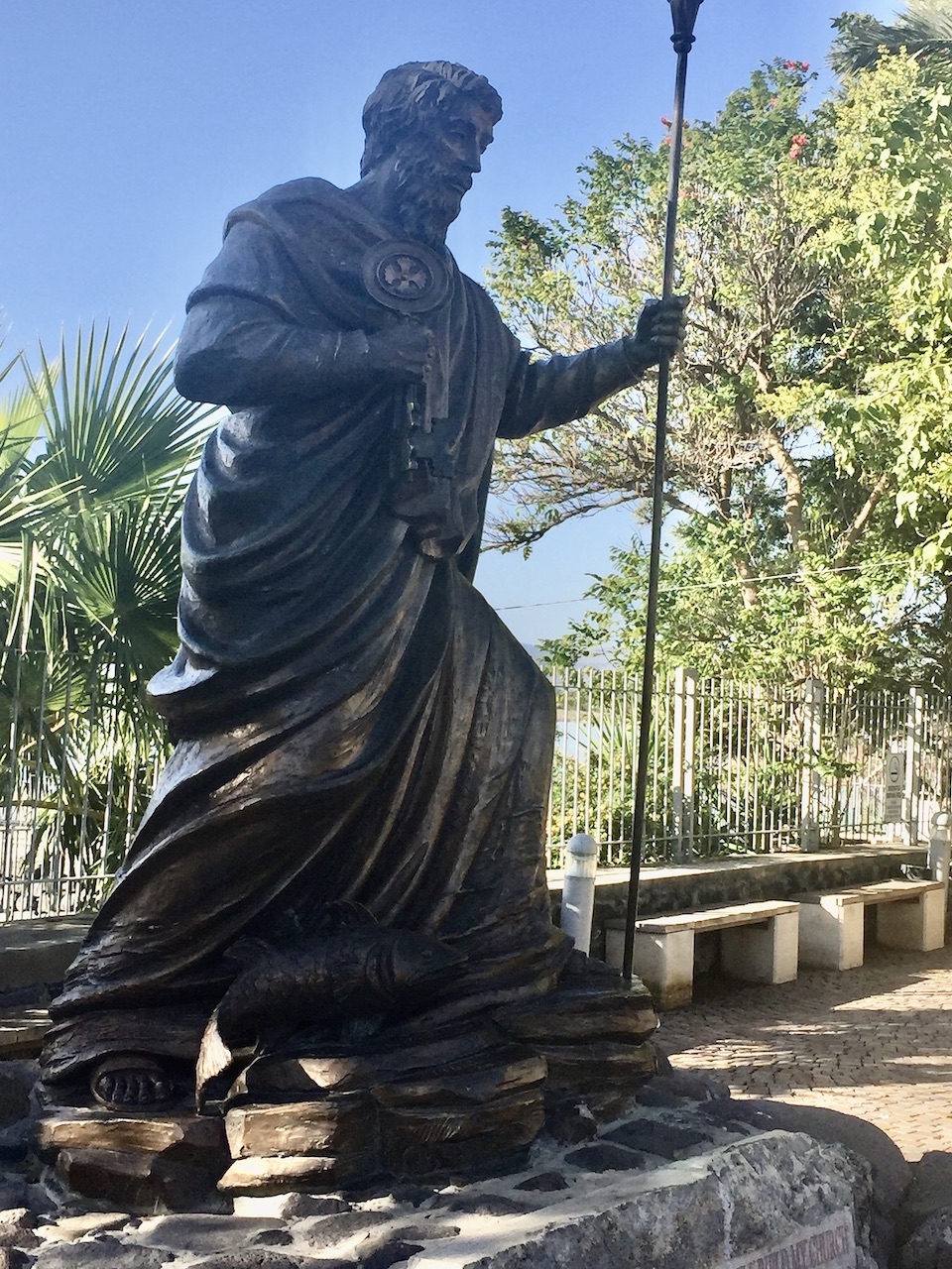
Capernaum was one of the most prominent towns of Jesus’ life. Looming 12 feet tall near the entrance to Capernaum, an imposing bronze statue of the Apostle Peter actually weighs a ton. You can see in the picture that he has a fish at his feet, a staff in his left hand, and a gigantic key in his right hand. The keys represent the divine authority that was vested in him by Jesus Christ.
Interior of St. Peters Church
Statue of St. Peters
After Capernaum, we stopped at a working Kibbutz called Ami’ad for a walking tour.
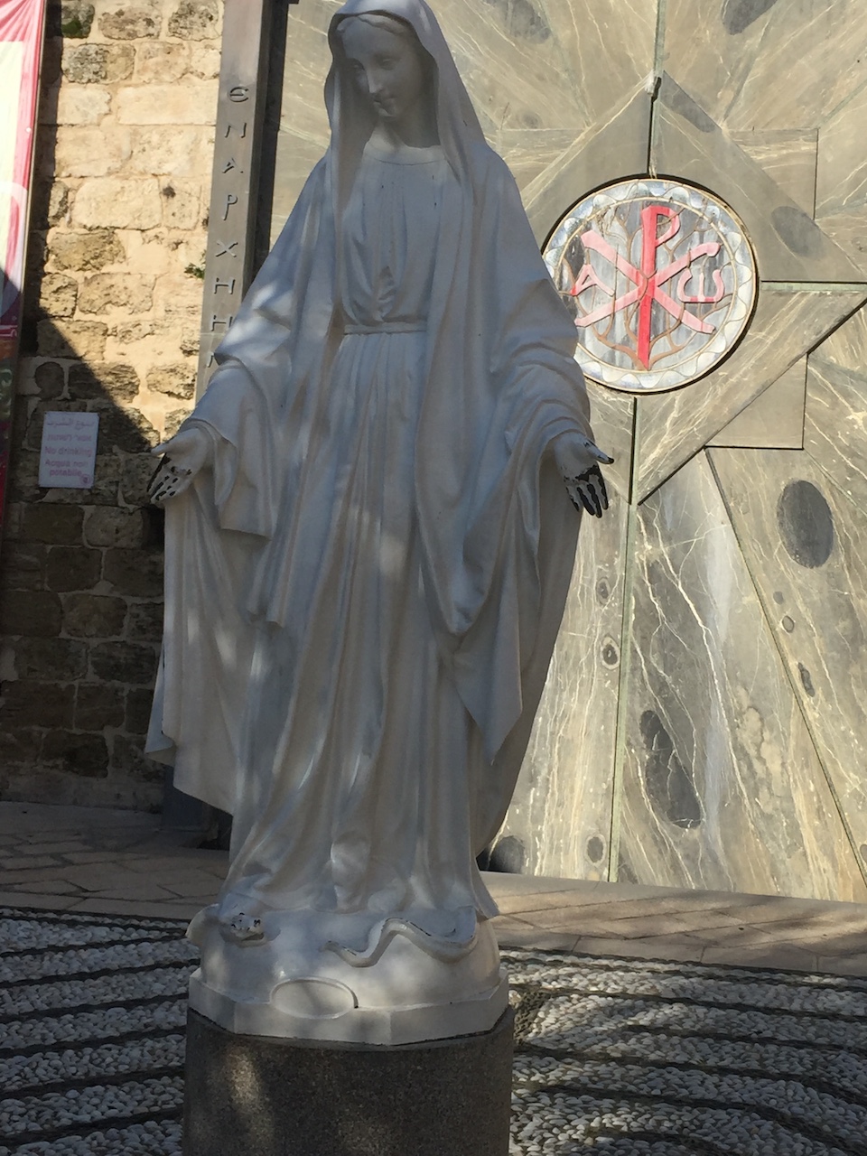
Nazareth is the largest city in the Northern District of Israel. Because a majority of the population is Arab, it is known as the Arab capital of Israel. But it is a sacred town where Jesus spent his childhood. A beautiful church of Annunciation is built over the cave (Grotto) which was the home of the Virgin Mary, and where, it is believed that Angel Gabriel appeared to her and announced that she would conceive and bear the Son of God.
Church of Annunciation (Front View)
Church of Annunciation
Church of Annunciation
The Church of Annunciation has two different floors: a grotto, and the top of which is the main church. Scene (above ) is part of the Grotto which was turned into a worship place in the 1st and 2nd centuries.
Worship area in the Grotto, Annunciation Church
Nativity Scene
Pomegranates, Nazareth
Pomegranate is a symbol of plenitude, abundance, and hope. Pomegranate has 613 seeds and corresponds to 613 commandments of the Torah. And according to the Jewish tradition, it is a symbol of righteousness.
Right outside the Church of Annunciation, they were selling freshly made Pomegranate juice, which most of us had, was delicious.
After spending two days in Tel Aviv, we left for the Sea of Galilee. On the way to the Sea of Galilee, we had a few stops. A thunderstorm and high winds greeted us, but it was warmer. The rain relented, giving way to strong gusts making it difficult even to balance yourself in Caesarea, a town on the Mediterranean coast midway between Haifa and Tel Aviv. It is a historic port with Roman Amphitheater and Hippodrome and an impressive aqueduct, all built when Herod the Great constructed the port of Caesarea in the First century BC.
Amphitheater, Caesarea
The picture below shows the large circular open-air amphitheater with the seats raised to protect the audience. Amphitheaters were used in Roman times for events such as gladiators and maybe execution. They are still in use for cultural events.
Oval Amphitheater, CaesareaHippodrome, Caesarea
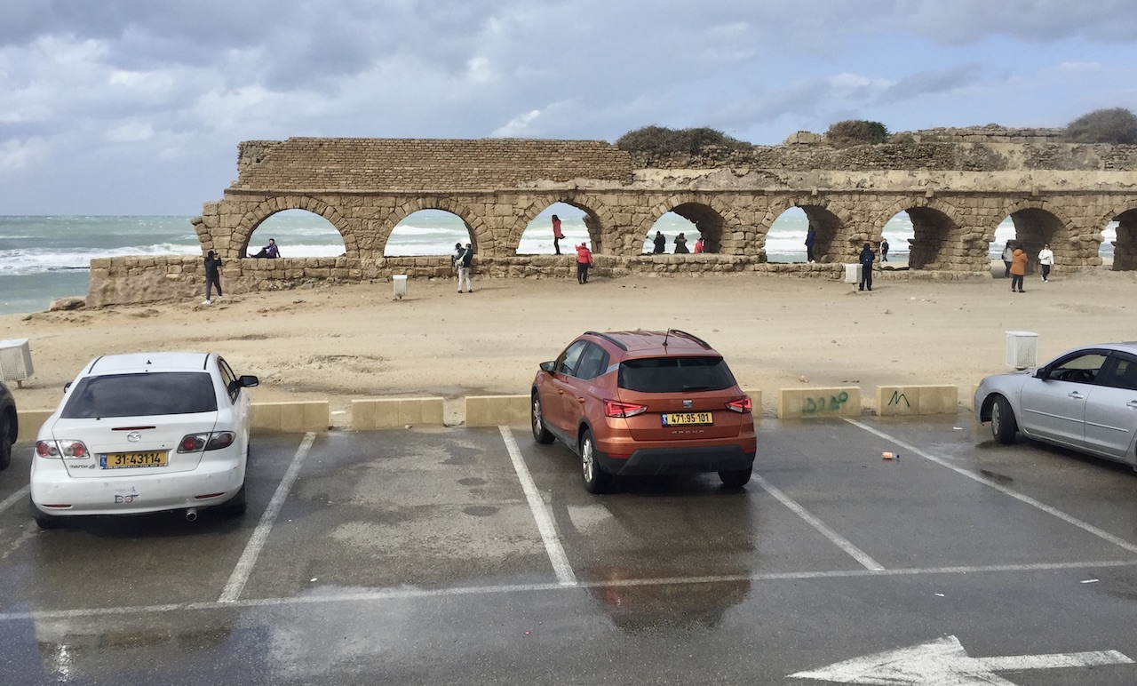
The aqueduct in Caesarea, Israel’s most famous attraction, was built by Herod the Great to carry water to Caesarea from the springs near Shuni, 16 kilometers northeast of Caesarea, the distribution point.
Israel was never on our bucket list. But recently some of our friends visited Jerusalem and that made us interested in visiting Jerusalem, as well as Tel Aviv which we thought might be a fascinating vacation. Further changes meant the inclusion of Jordan in the package. So our trip to the Middle East with Gate 1 Travels was planned, which included Tel Aviv, and Jerusalem in Israel, and Jordan. On arrival at Tel Aviv airport, we were transferred to the Cinema Hotel which was a movie theatre (an interesting detail) before it was a hotel, hence the name.
They maintained the cinema theme by placing cameras of all shapes and sizes all over the building which made me feel as if we were under scrutiny. Right across from our hotel was another hotel called Center chic Hotel, which is part of the same chain. They offered happy hour to the guests of the Cinema Hotel between 5:30 and 7 Pm. It turned out to be very convenient for us to relax and grab a bite before an hour-long orientation for our upcoming, rigorous sightseeing schedule, to be delivered to us by our Tour Manager, Tal. He had a merciless approach to maintaining strict timing by exacting obedience from all passengers regardless. The early start was extremely important, he said because there was going to be a three to four hours bust ride followed by walking on uneven surfaces, steps, and significant slopes. Introductions were done, whispers distributed and instructions given which were fairly clear. This leg of the trip was going to be in Tel Aviv and Jerusalem. Our extended 5 more days was the visit to Jordan. We were also informed that those who are visiting Jordan would join a tour group designed for Jordan by a Jordanian tour manager.
Tel Aviv
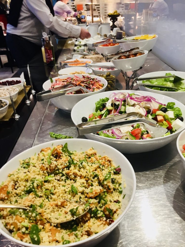
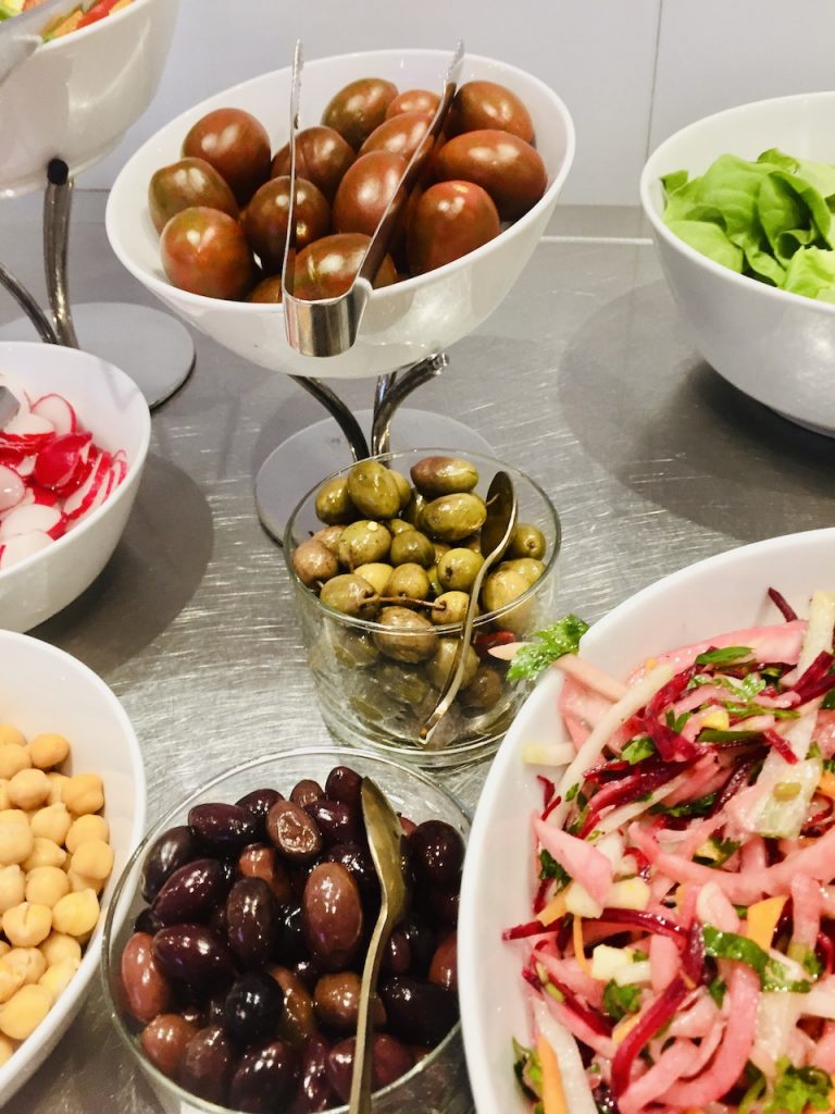
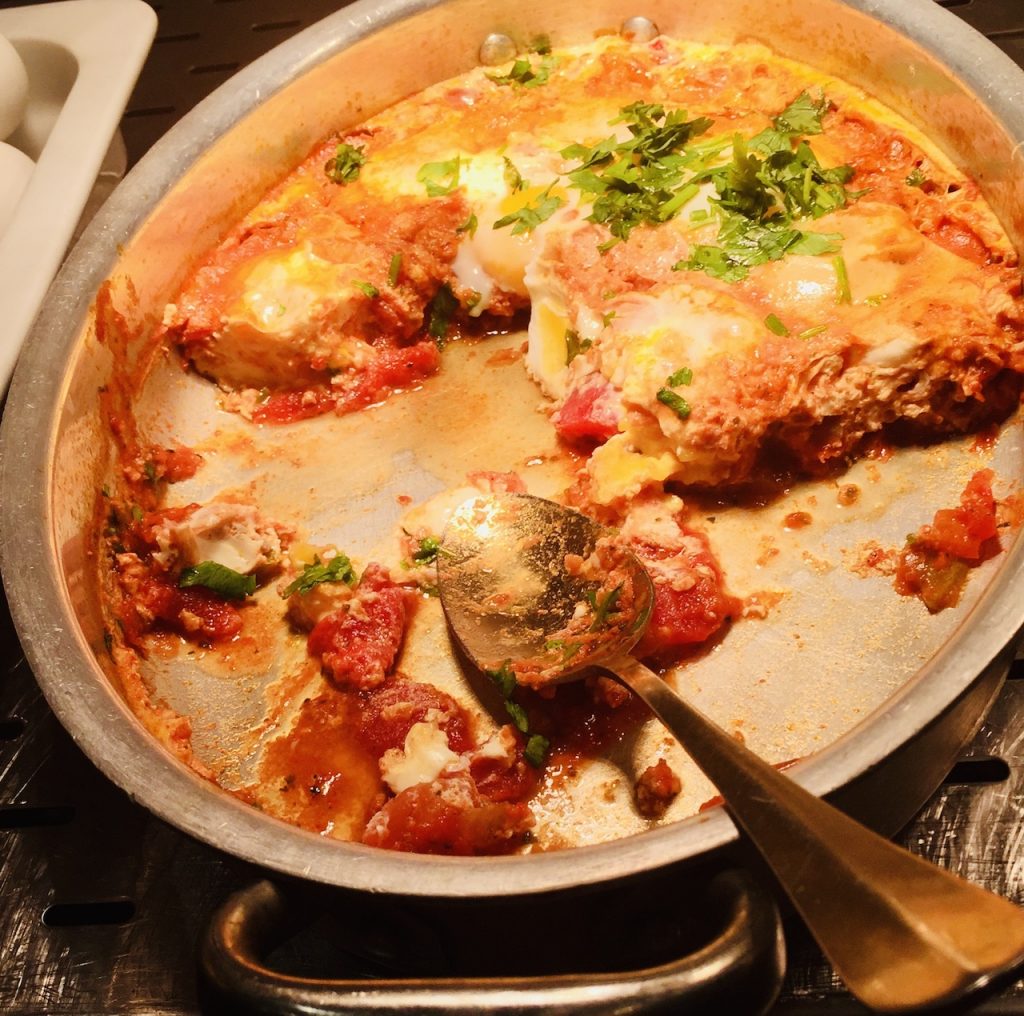
Our day started with a magnificent breakfast spread in the hotel restaurant. Pictures below give only a glimpse of what was a feast. I was glad to see that the most popular dish seemed to be shakshuka, eggs poached in tomato sauce. We have a very popular breakfast item which looks and taste very similar to shakshuka called khagina, with a difference that we poach eggs in an onion sauce which is eaten with Indian paratha). Breakfast was served as a Buffett where you helped yourself to whatever you wanted and repeated as many times as you want. Coffee was the only thing you could order and get served on the table.
Breakfast items
Breakfast items
Shakshuka,Breakfast item
Gate of Faith
After this sumptuous breakfast, we started visiting Jaffa Tel Aviv, the oldest part of Tel Aviv. It is a port city of historical importance on the Mediterranean Sea coast and has become a top-rated attraction for tourists with art galleries, restaurants, museums, and nightclubs. Our first stop was Gate of Faith. A doorway-shaped sculpture that symbolizes an entry to the Land of Israel and has three sculpted biblical stories of Abraham, Isaac, and Jacob on the pillars and top depicts the conquest of Jericho.
Gate of Faith, Jaffa Tel Aviv
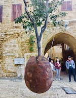
From there we walked around in narrow alleyways of Artist’s Quarters and saw a suspended orange tree in a stone. Apparently, an artist’s creation pays homage to bygone Jaffa oranges, and also to symbolize mankind’s disconnect from nature. It was an experience in itself.
Orange Tree suspended in a stone, Artist’s Quarters in Jaffa Tel Aviv
Pictures below show some of the historical sites we saw on our walking tour.
Ottoman period wooden train display in Jaffa, Tel Aviv.
Ottoman Era wooden Train
Al- Bahr Mosque: The oldest mosque on the Mediterranean coast built in the 16th century is still existing. Muslims have not been allowed to enter the mosque since Palestine was occupied in 1948.
Al Bahr Mosque, Jaffa Tel Aviv
Great Mahmoudiya Mosque is the largest mosque in Jaffa and can be spotted from anywhere in Tel Aviv. Call to prayer cannot be sounded because of its busy location. Despite this, it is a busy mosque of the area. Locals as well as pilgrims from far afield come there to worship. However, non-muslims cannot go into the building itself.
Mahmoudiya Mosque, Jaffa Tel Avive
The Jaffa Clock Tower was built in 1901 in the center of Jaffa’s town Square. It was built to pay homage to the Ottoman ruler and his vast empire. This is one of seven towers that were built in Palestine during Ottoman Period. The one in Jerusalem was destroyed at some point.
Clock Tower, Jaffa Tel Aviv
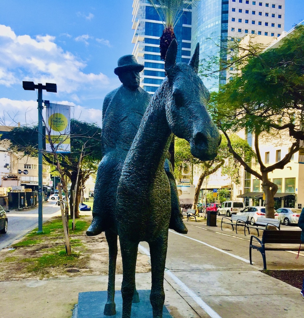
Meir Dizengoff was the mayor of Tel Aviv, and a pioneer of modern Zionism. He gave his house to the city which became Independence Hall. This statue below is located on Rothschild Boulevard, across from Independence hall is a tribute to the mayor .
Meir Dizengoff Statue, Rothschild Blvd. Jaffa Tel Aviv
This ended our walking tour, and we headed out to our hotel for lunch and rest. We were glad to take it easy before we hit the road the next morning.
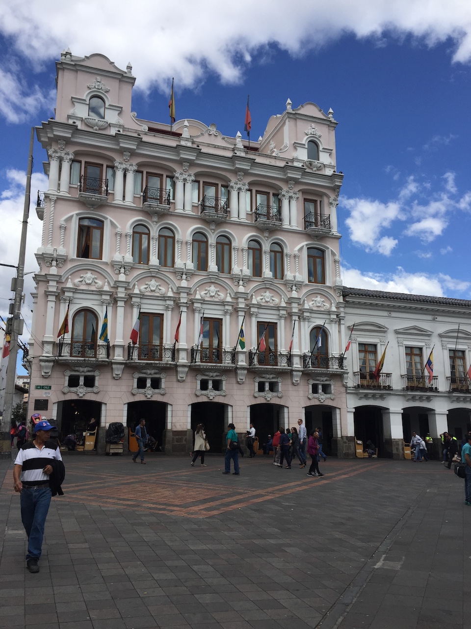
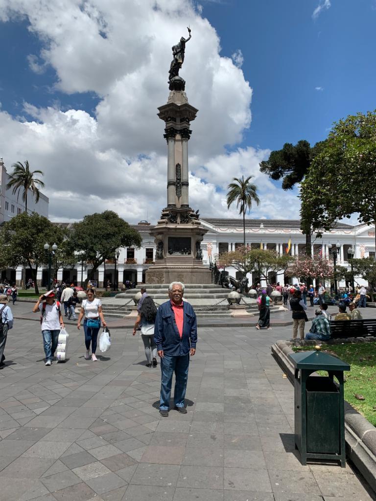
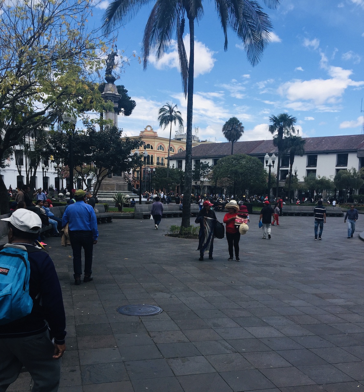
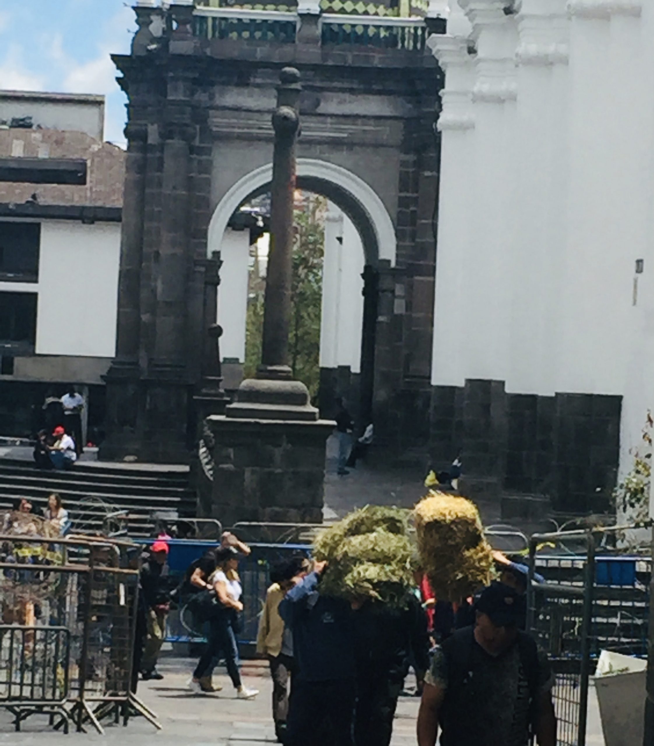
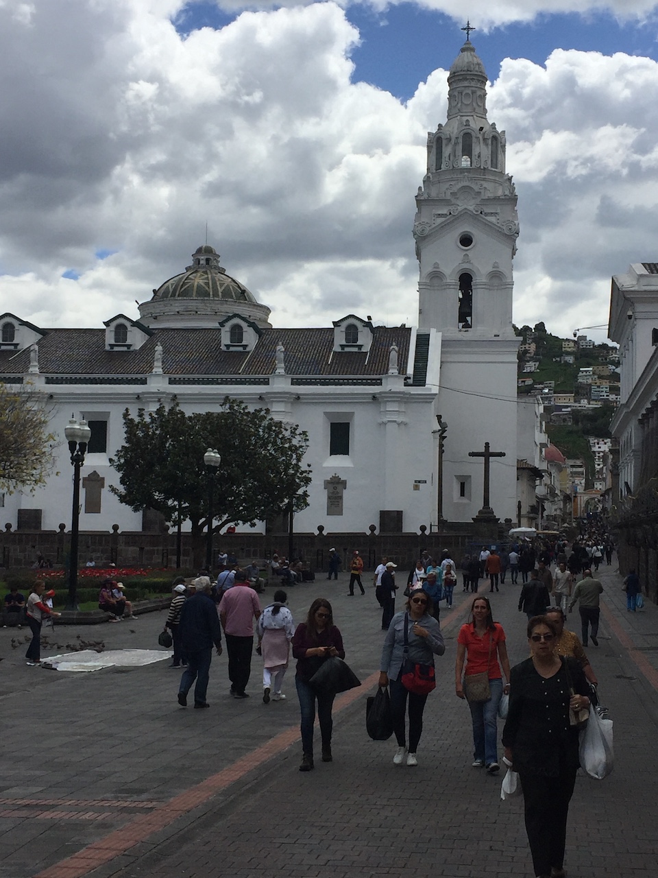
Most tourist do the walking tour of Historic City Center in Quito on the first day or two of arrival to keep a slow, relaxing, pace and take it easy to get used to the altitude and prevent altitude sickness. As we had time constraints, we did our major sightseeing first and left the highly recommended historic center for the last. We were staying very close to the City Center area which we knew to be a pedestrian zone, we didn’t need to take a tour or even to hire a cab for the day. We just needed a cab or an Uber to be dropped off at the point from where we could walk around the historic city center’s pedestrian zone. Our Uber dropped us at the entrance point to the pedestrian area of historic city center. At first, it seemed very intimidating because everywhere we turned it seemed like we had to walk uphill, which wasn’t something we welcomed. But as we asked around we found a very kind older gentleman who showed us the best way to navigate the streets in the area starting with the Independence Square, and by walking along the Garcia Moreno street along which lot of the major sights are locate. Independent square is one of the symbols of the executive power of the nation. We realized that we were standing right at the entrance to the Independence Square and all we had to do was to walk down and start there.
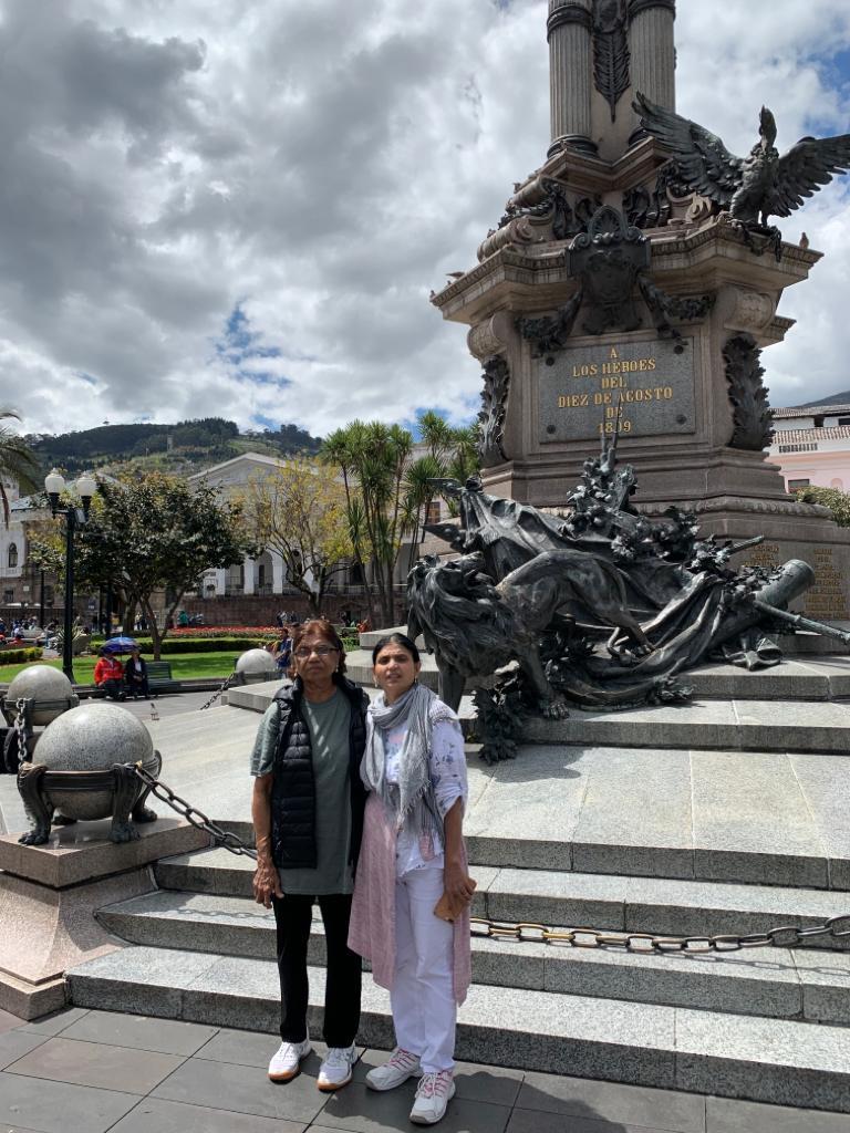
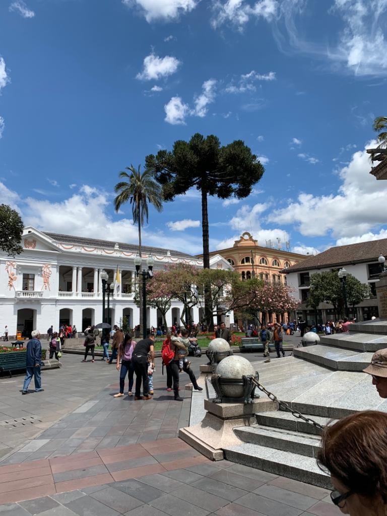
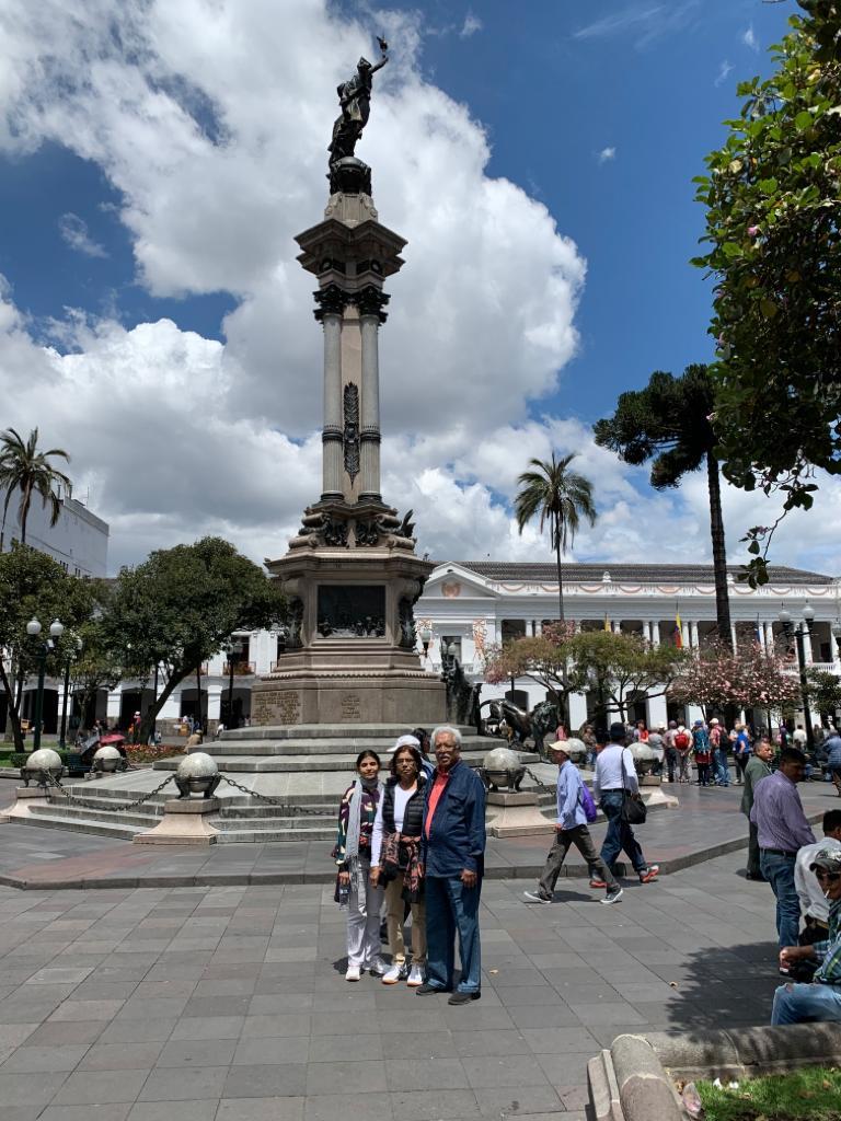
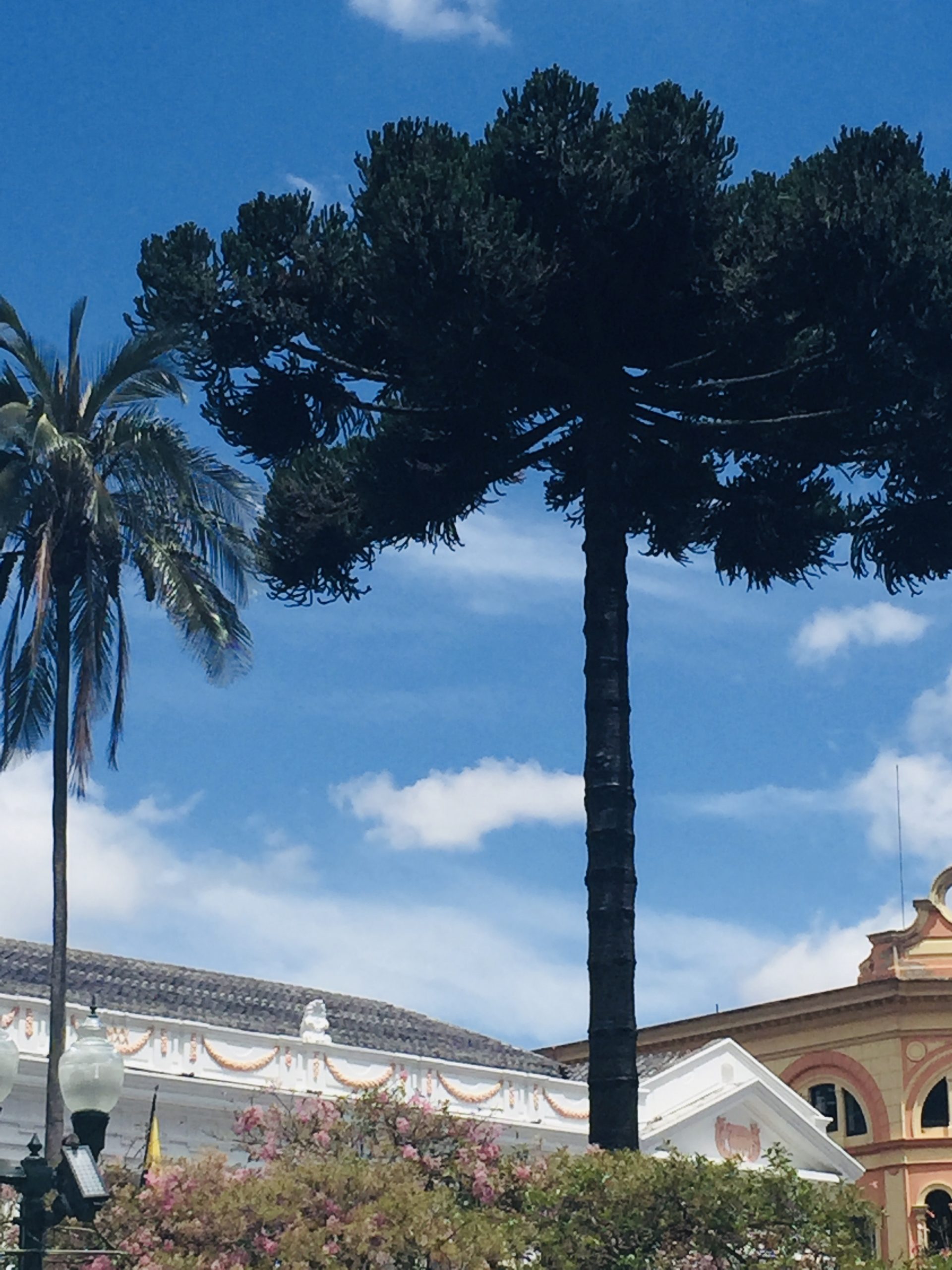
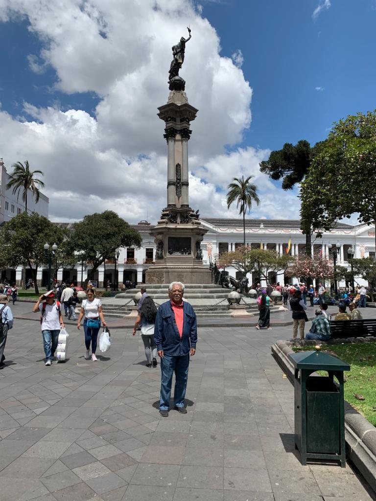
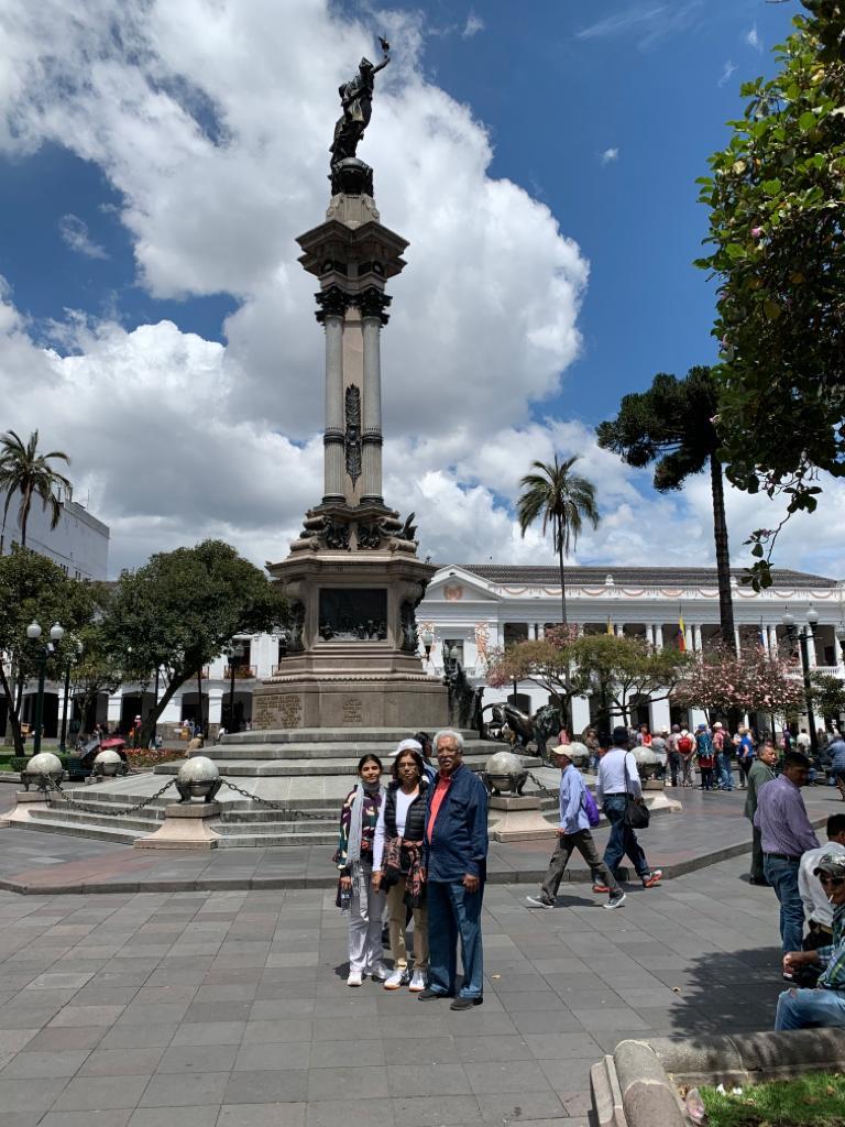
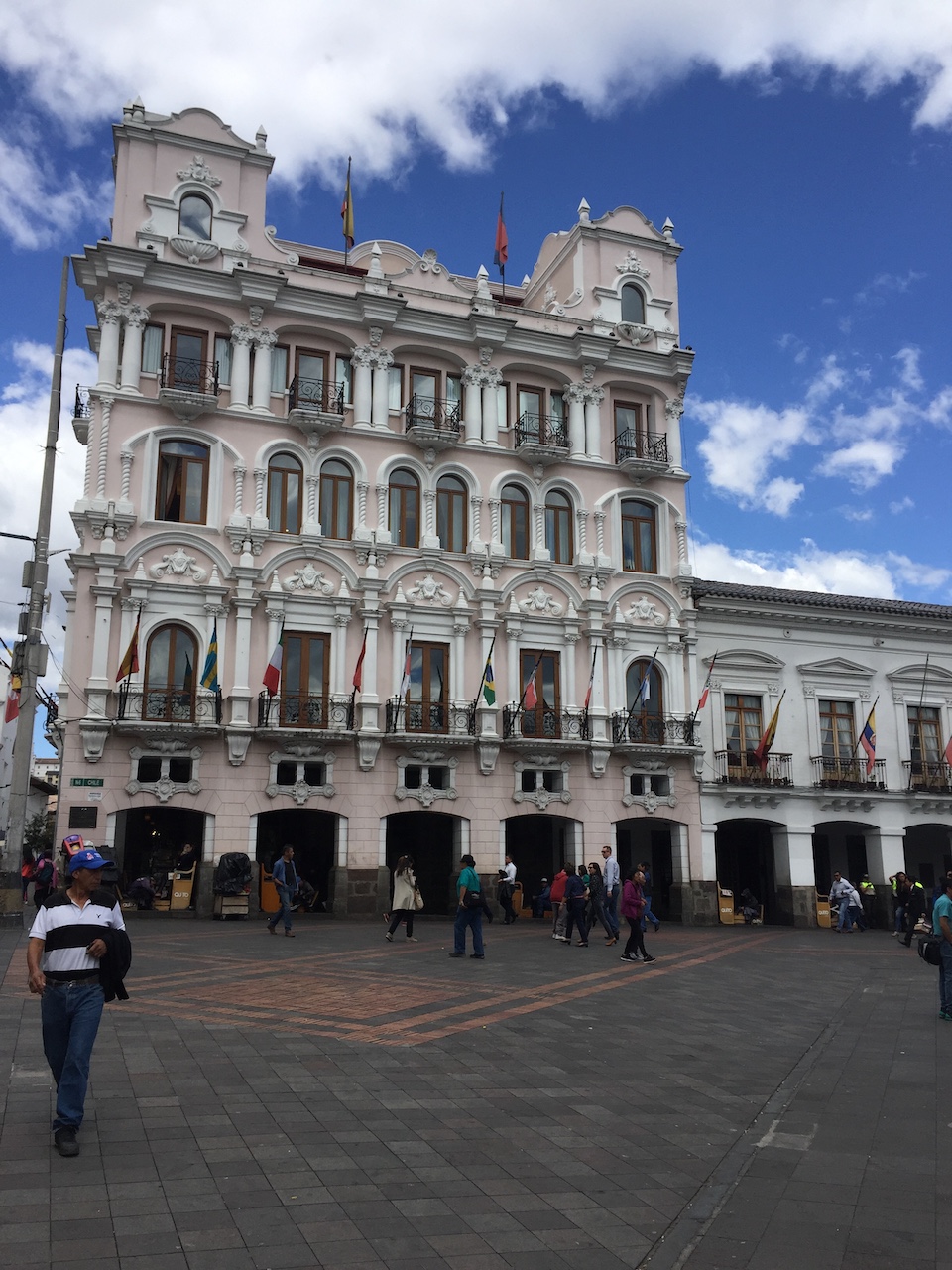
The main feature of the independence plaza is the monument to the independence heroes of August 10, 1809 right in the center of the plaza. And the buildings around the square retained their original architectural features. Because of its preserved originality Quito became the first city to be declared UNESCO World Cultural Heritage Site in 1978. One could experience hundreds of years of Quito’s past in one day when visiting the historic center. Although I am blissfully ignorant about architecture, I couldn’t help but notice that most buildings were built in Spanish Colonial style.
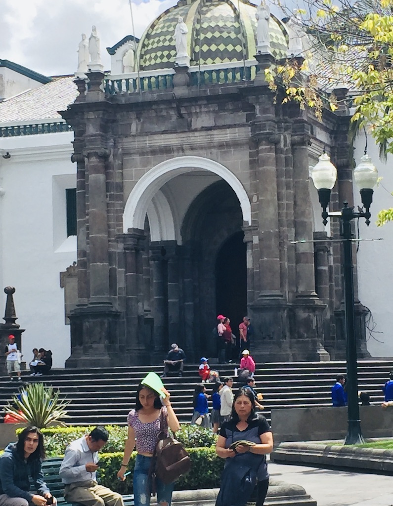
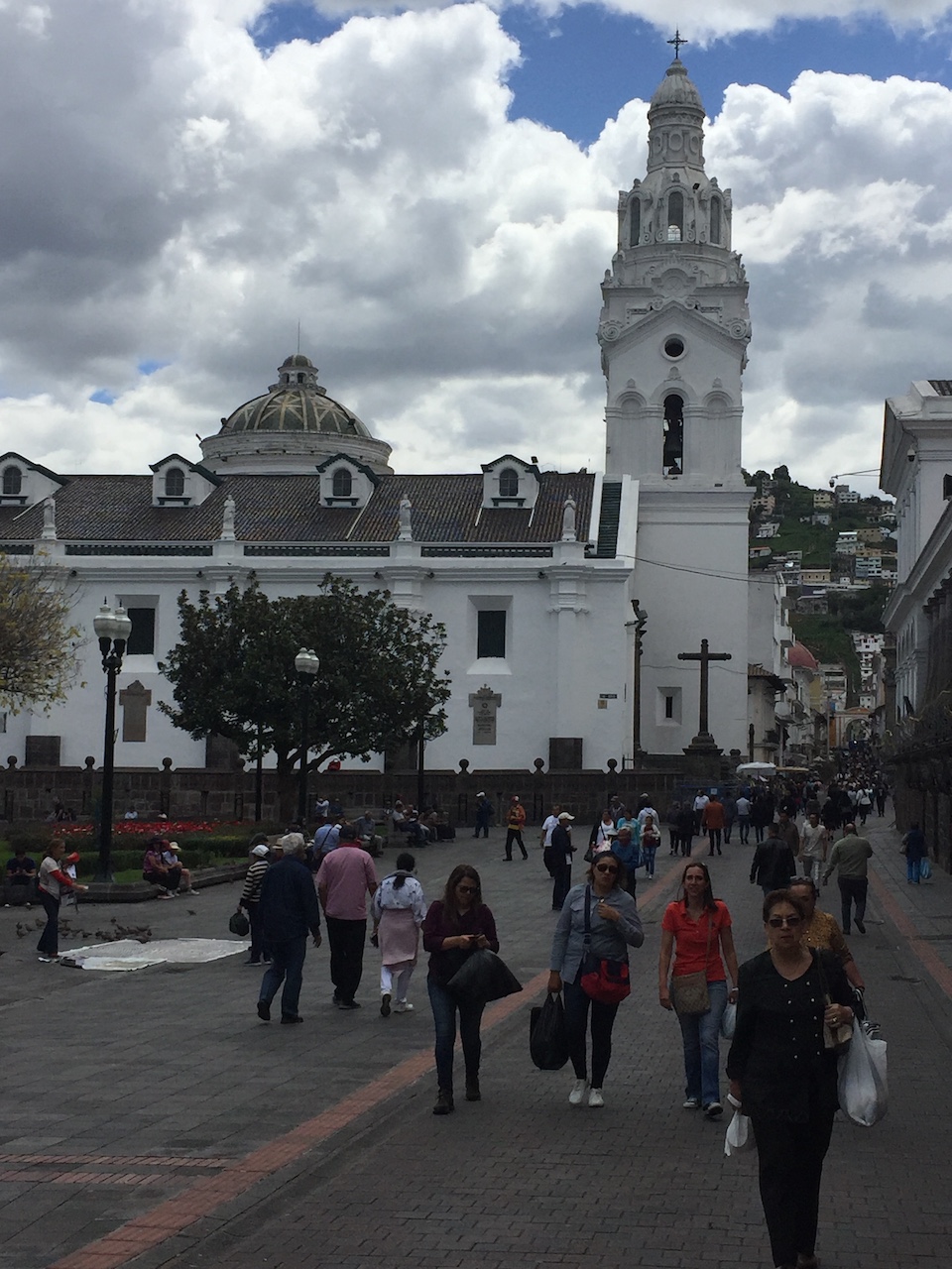
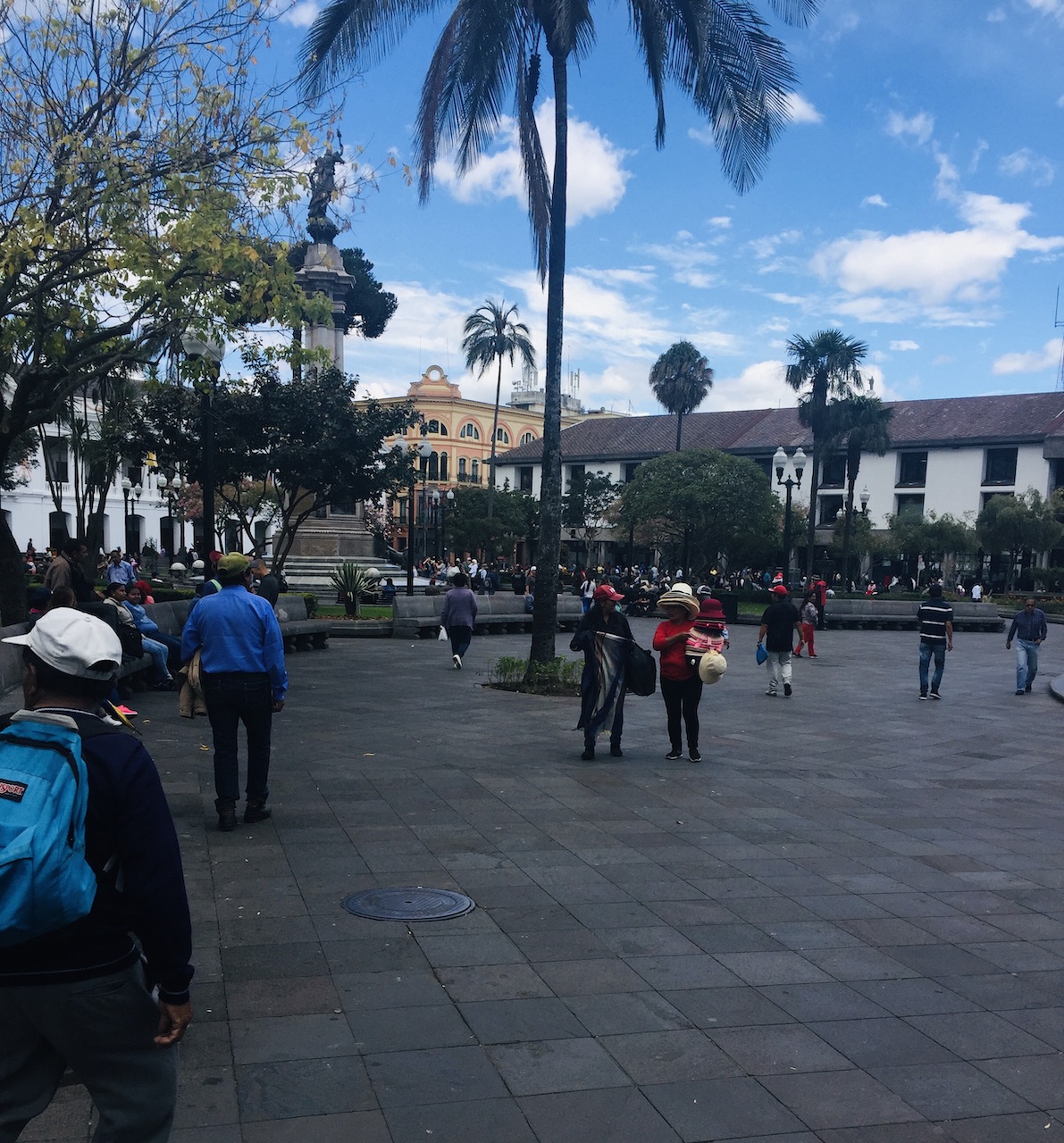
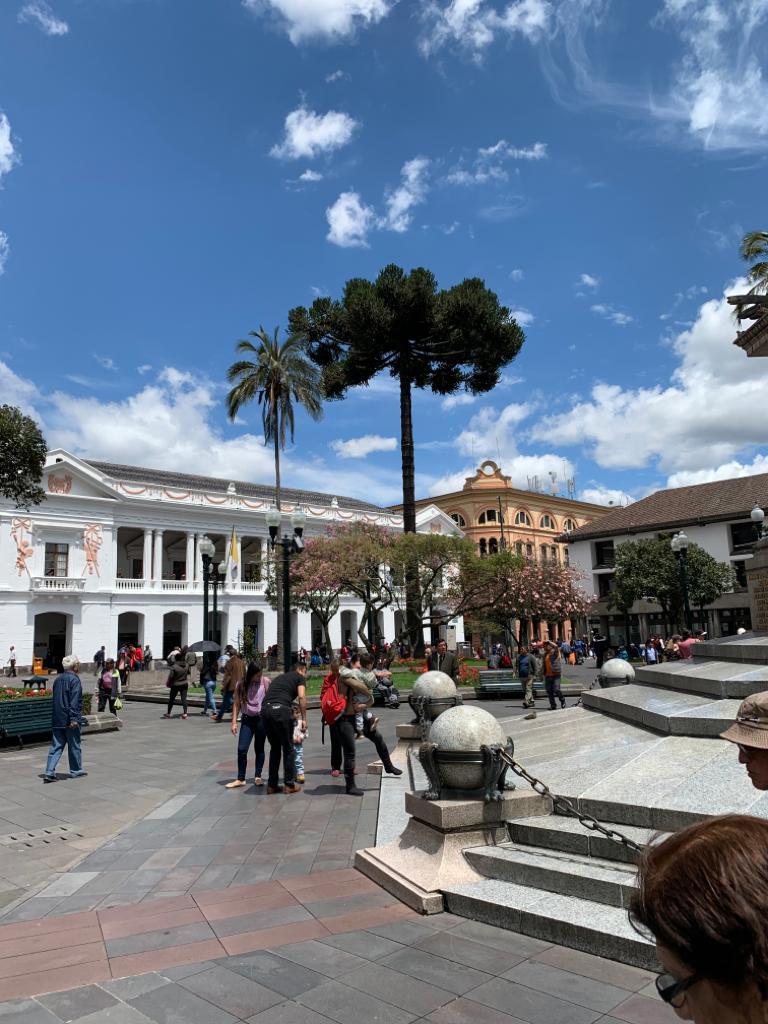
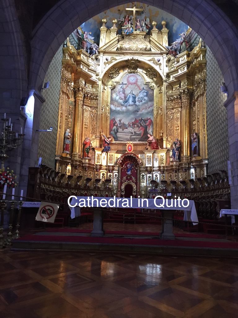
Independence Square in Quito is a great place to hang around, relax and soak in the sights. It really welcomed us with its friendly vibrant atmosphere. It is really a square which represents history, culture and everything invaluable to the city. In other words it is the beating heart of the city. All four sides of the square has important buildings such as Archbishop’s Palace which was residence of Bishop for many years; The City Hall where municipality of Quito is located; on the south side Quito’s Cathedral which makes its daunting presence felt by stretching over a huge area; west side of the square in taken up by Palacio del Gobierno, Carondelet Palace, from where Ecuadorian president works. Apart from these buildings Independence square is surrounded by shops and restaurants.
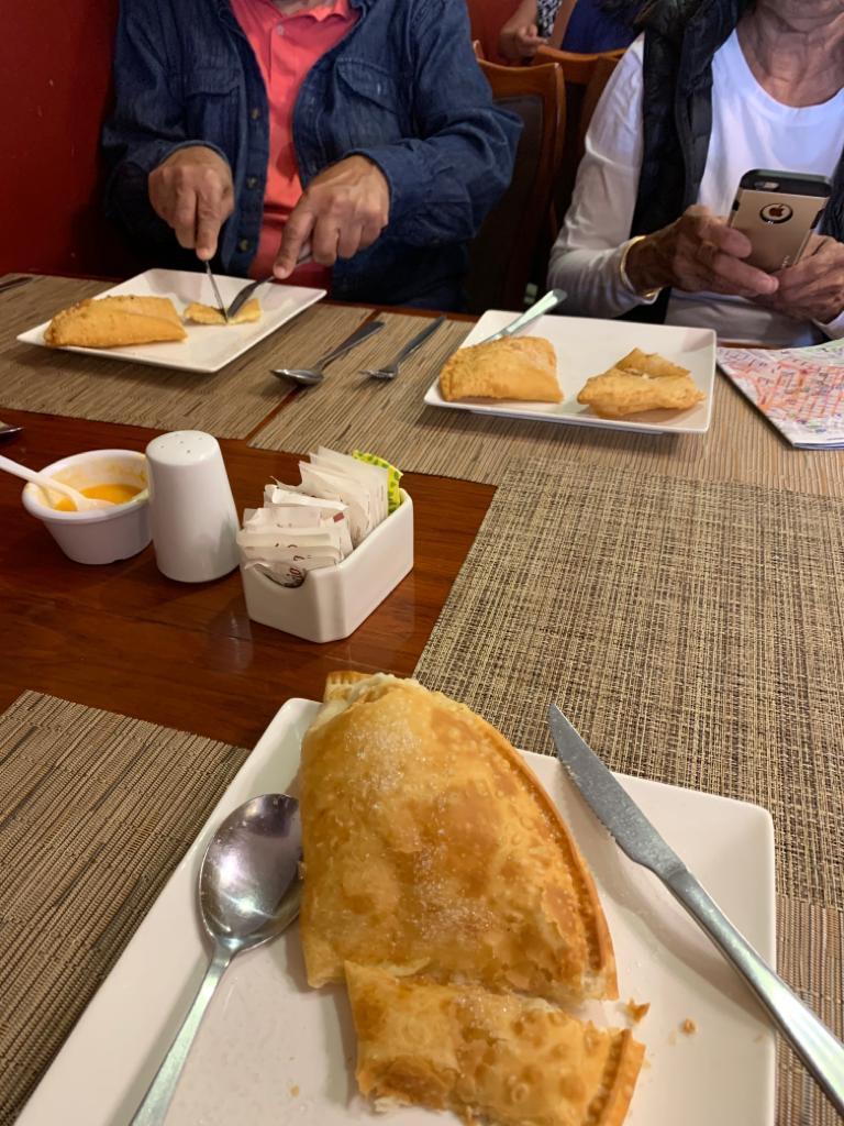
While we walked on Garcia Moreno street, we found a nice restaurant/cafe where we stopped for a great coffee and a snack of cheese and onion empanadas, item peculiar to Ecuador. We also had a traditional meal for lunch, along with ceviche made right on the table as an appetizer, in the same restaurant the following day.
Cheese and onion Empanada
On the table Ceviche ingredients
Lamb stew for lunch
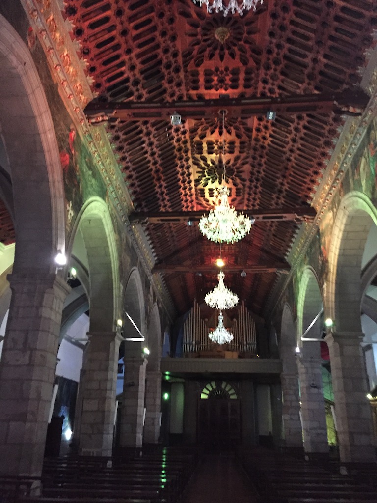
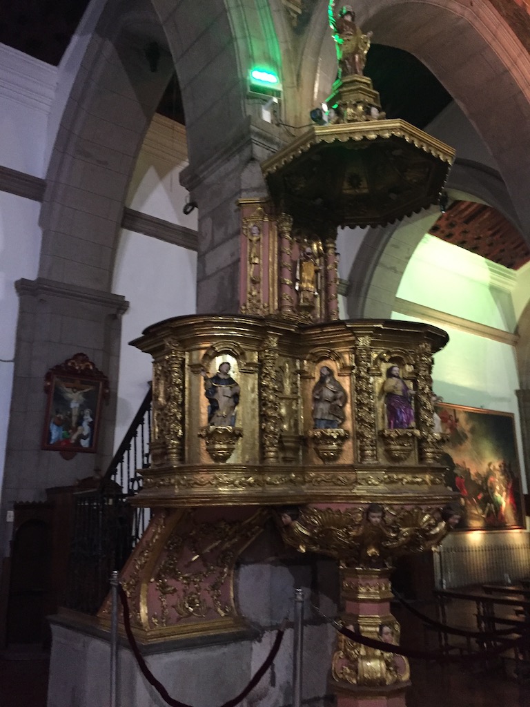
We visited the Church of la compañia de Jesús also on Garcia Moreno street, one of the best known churches in Quito because its central nave is decorated with gold leaf, gilded plaster and wood carvings.
Exterior and interior of Church of la Compaña de Jessu
Walking up the Garcia Moreno street, we could see the Statue of Virgen, way in the distance on top of el Panecillo, an amazing sight. It is world’s tallest winged, aluminum statue of Virgin Mary visible from everywhere in the city. We were able to hail a cab to go to El panecillo. The Statue of Winged Virgen is only referred to as El panecillo. The cab driver insisted on correcting us when we said Statue of Virgen by repeating El Panecillo. The hill was, apparently named El Panecillo because it resembles a loaf of bread. This hill which is 656 feet high(200 meters) was chosen to erect a 135 feet (41 meters), high, including the base, replica of Virgen Mary making it a highest, and largest winged aluminum statue in Ecuador, and in the world. It is made up of thousands of individual pieces of aluminum. Apart from the wings, the Virgen stands treading on a snake( and some say a dragon) upon the globe. There is a small museum inside the base. We had to pay $2/- per person to enter the museum. There were stairs to climb up to the top for highest viewing area. We went part of the way but turned back halfway because it was very tiring. The statue is definitely worth seeing up close, and the views of the city even from el Panecillo itself were Phenomenal.
This completed our vacation in Quito. Although there were not many cabs around, we were lucky to get a cab back home. Our last evening in Quito, we got ready to leave bringing our Ecuadorian fun and adventure to a very satisfying finish. We were ready to go to the airport for our flight back home the same evening.
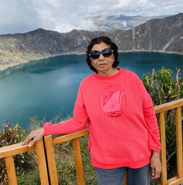
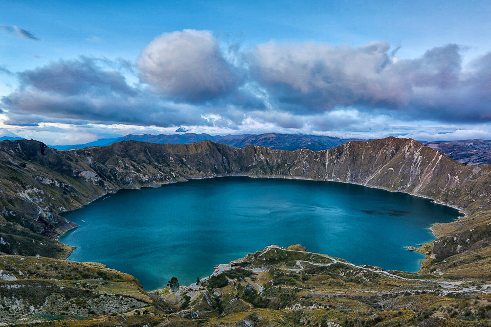
It was November 6, our trip to Quilotoa was planned. We left again around the same time as we did for Cotopaxi Volcano the day before. Quilotoa Volcano is one of the most popular attractions in Ecuador. The last time Quilotoa volcano erupted was in 1280 which formed 3 km gaping Caldera by the collapse of the most western volcano in the Ecuadorian Andes. This caldera located in Cotopaxi province is filled with brilliant, stunning Sapphire water as a result of dissolved minerals is an amazing site for the visitors to the area.
Laguna-Quilotoa
When we left in the morning, we knew that Quilotoa was farther away from us than Cotopaxi where we went the day before. If you are lucky to be in the country and have extra time, you should make both Cotopaxi and Quilotoa an essential part of the itinerary and combine the visit over 2 to 3 days. This will not only save unnecessary travel time in the same direction, but also give you time to do activities such as horseback riding in Cotopaxi and hiking the Quilotoa Loop. For us that was not an option. We had limited time, we did day trips to both Cotopaxi Volcano and Quilotoa Lagoon. We just stayed around the Quilotoa lake and enjoyed stunning lagoon, amazing nature, and epic landscapes making it a highlight of our stay in Ecuador.
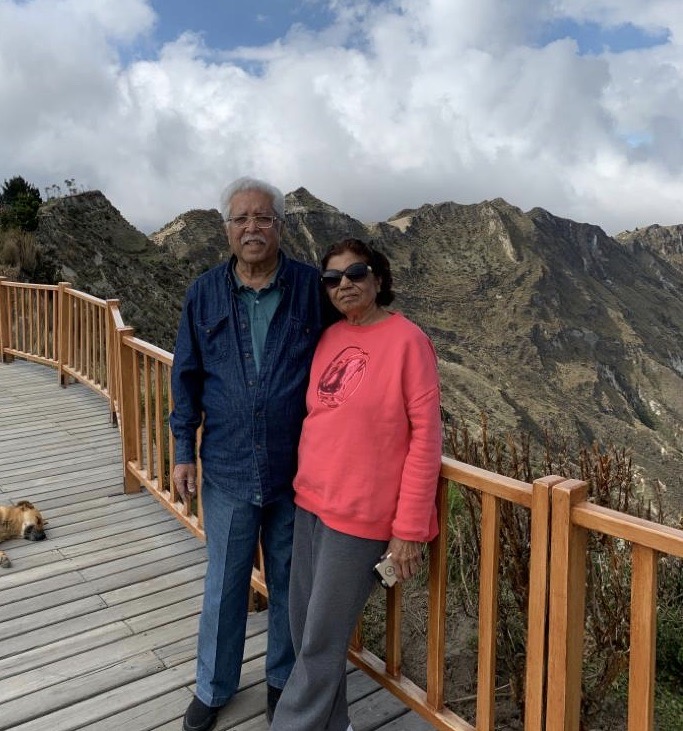
Rugged mountain area surrounding Quilotoa Lake
At an elevation of around 3,800 meters, Quilotoa Lake is a sight to behold. Daunting Andes mountains surrounded this beautiful Sapphire gem as if hugging in a tight bear hug.
views.
There was a shopping area where there were big warehouse style artisan and craft stores near the lake . We spent some time and looked at the things there. Merchants were, obviously, anxious to sell their goods but we didn’t have enough time to look as it was getting late, and a long drive was ahead.
Town of Quilotoa, and Jose with his car.
At this point, we had two more days left to explore the Historic City Center, in Quito, Ecuador. Since we were staying very close to the City Center area, we did not need Jose to come back for the day. City Center in Quito has all pedestrian streets. We just needed a taxi to be dropped off at the point from where we would be able to walk around the Historic City Center’s pedestrian zone. Hoping for a lot of fun. Still no altitude sickness!!
It took me a long time to get back to my writing because of other commitments. I can’t wait to tell you all about Cotopaxi. It was only day three, Monday, November 5, in Ecuador for us. We covered four important sites the day before. Since we were in Quito only for a total of 5 days, our plan included Cotopaxi, Quilotoa, and Quito’s, much recommended, Historic City Center.
We were ready to take on Cotopaxi, which is one of the highest active volcanoes in the world. The trip, we were told, would take the whole day because it was almost more than two hours away from Quito. We arranged a taxi for 10:30 departures, which gave us ample time to get ready, and have breakfast. Since we were not too impressed with coffee at Ambato Bakery the day before, we decided to pick up our favorite breakfast items from there and have breakfast at the apartment. Was it a great idea? The answer is that that was the only breakfast we had in the apartment.
Our taxi was on time, we carried everything we needed including some snacks and drinks. The drive turned out to be very pleasant and stress free. We were going through a stretch of high, winding road with a view of mountains that created a backdrop to layers of trees and fields that were many different shades of green and looked as though borrowed from fairy tales. Gazing out of the car windows forced us to relax and enjoy the phenomenal nature’s panorama.
Mountains and fields of different shades of green
Jose, was a great driver and gave us the information about the places we were passing on our way to Cotopaxi, and answered all the questions we had for him. Call it a bonus for me, because I was an interpreter between him and the rest of us, conveying information accurately from Spanish to English and vice versa.
When we first arrived at the entrance of the park, we were to register at the main ranger station. They wanted passports or driver’s license for identification. After the registration, we had to hire a local guide/driver to drive us around. The guide/driver, Marco, was the only one around at the time, therefore, he was assigned to the task. He spoke limited English which was bordering on non-existent. But fortunately he spoke immaculate Spanish. Marco, as I found out during the course of my conversation with him, was an indigenous Ecuadorian whose first language was Qechua, and Spanish was his second language. And he was a college graduate. Not only his command of Spanish was impressive, but his accent did not seem to have strong Qechua influence which would have been hard for me to understand.
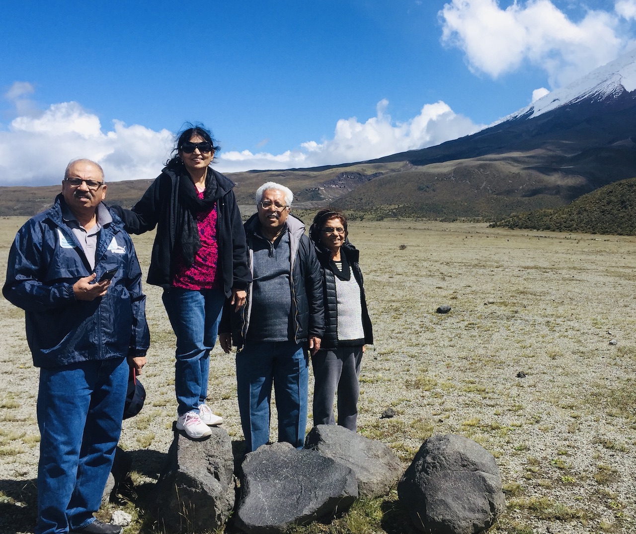
Marco drove us to the base of Cotopaxi volcano at 3,892m (almost 13000 ft.) and surrounding Cotopaxi National Park. The park spans 84,000 acres (34,000 hectares) and encompasses three volcanoes. Immensity of the Park and its spectacular surroundings was beyond description. It was a clear, beautiful day and yet you could see that Cotopaxi was totally shrouded by snow white fluffy clouds, its conical shape reminded me of Paramount picture logo. You could just steep in nature’s splendor even without being a climber or a hiker. As we stood alongside the mountain we were able to palpably see the clouds roll over the peaks making it an ever more fascinating spectacle. These were the moments-in-time that wiped away all the anxiety making for a humbling experience and realization of man’s cosmic insignificance.
Cotopaxi National Park
Marco was a good guide, he stayed close to us and also acted as a cameraman. He pointed out a herd of wild horses near the road and gave a history of how the horses came to Ecuador. Apparently, there were no horses in Ecuador until the Spanish Conquistadors introduced them to the country. Since then Cotopaxi National Park has been a home to wild horses. I believe that our presence had been detected by the herd of wild horses grazing close to the road, because they started walking away at a good clip. It was very obvious that they didn’t appreciate intruders.
Horses at eh Cotopaxi National Park
After that we headed to Limpiopungo lagoon area where we spent some time, but not enough to even begin to get a sense of the place where there was so much to see and learn. The lagoon is at an altitude of 3800m and was formed by meltwater from the mountains and is a home to many bird species. A very clean, and well maintained walkway from where the views were pure bliss. The walkway was flat and delightful for a short stroll. The day we went was quite warm with no wind. We were told that the area has been in use as a campsite and also for picnicking. The rules were well established and enforced to prevent people from littering the area. There were signs for people to clean up and carry away their own trash. Great place to visit
Lake limpiopungo, Cotopaxi
I highly recommend it to those who have more time to spend in the area and a longer vacation in the country. After a very pleasant time, we headed back to where Jose was waiting for us.
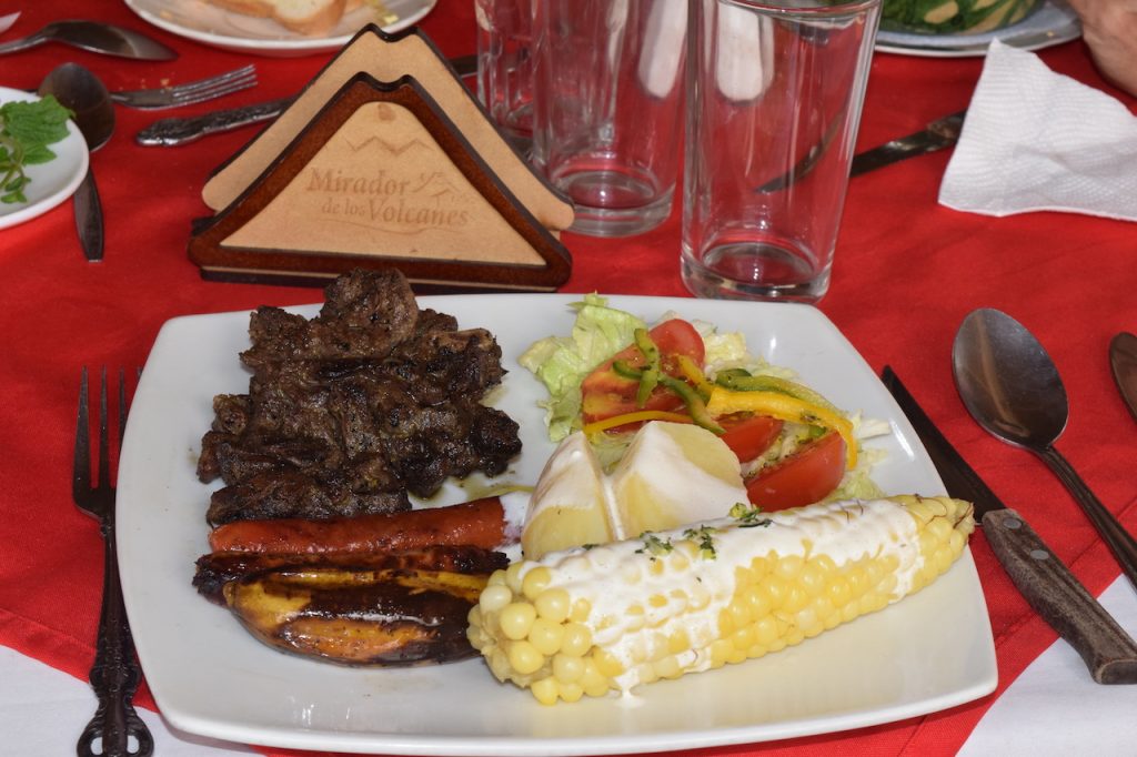
We planned to stop and have lunch on our way back. Jose and Marco decided on a place and we went to a restaurant called Mirador de los Volcanes (Avenue of the volcanoes). It was fairly big place with large windows all around, and from every direction you could see all three volcanes, the dormant Ruminawi Volcano, Sincholagua Volcano, and the largest Cotopaxi Volcano, in a line, hence the name, Mirador de los Volcanoes ( Avenue of the Volcanoes ). It was a humble family run restaurant with a good menu of grilled lamb, beef, and cuy (guinea pig) with potatoes, fried plantain, sausages, Ecuador corn with giant kernels, and avocado. Cuy (guinea pig) was highly recommended, but we opted for grilled lamb with all the sides.
Restuarant Mirador de los Volcanes
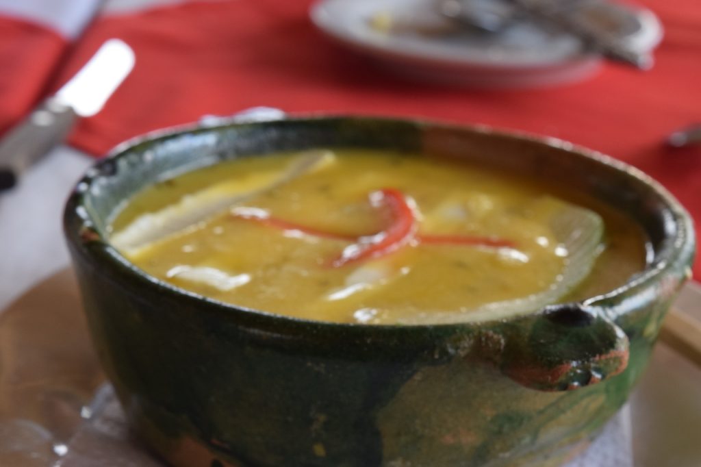
A dramatic start was given to our meal with freshly baked delicious, sliced bread with habanero chili sauce. Habaneros are very popular in South and Central American countries.These are very hot chilies, rated 1000,000 – 350,000 on the Scoville scale, which in layman’s terms deadly hot. That was not a problem for our group of hot food aficionados, we lapped it up. We were very hungry and this was a great appetizer. A second appetizer, called Locro de papa (Ecuadorian potato soup) was wrongly named, because it did not look appetizing, but, I would say, it was just as memorable. It had chunks of potatoes, (I supposed for added texture), in the soup, and was garnished with crumbled Queso Fresco, cubes of avocados , and julienned pieces of red bell pepper. Surprisingly, it was a big hit with everyone.
The meal came in large plates with grilled lamb and all the aforementioned sides. Service was prompt, people were friendly, and the food was good. A great opportunity to experience Ecuadorian cuisine, and a peek into their indigenous culture. Leaving the park I felt a little sadness, as I left a piece of my heart in Cotopaxi
After the bill was settled, and as we left we knew that the drive back would be tiring. It went really well in the beginning but turned treacherous when we hit unexpected traffic jam. It took forever to get back. By then we were ready for a light supper and a good night’s sleep.
The next day we were to visit Quilotoa Volcano and its deep-blue crater lagoon that was formed 800 years ago after an eruption carved a large crater on top of the peak. More on that later.
Follow:
Welcome
Welcome to my blog. Feel free to check it out and leave me a comment, if you find something interesting.